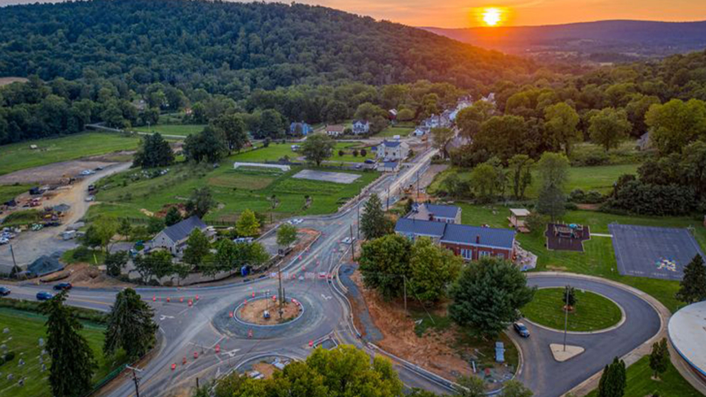
Through the Rethink Route 9 Traffic Calming Project, the Town of Hillsboro set out to calm traffic, improve multimodal safety, and upgrade essential infrastructure along its historic Main Street. The improvements included two roundabouts, three multi-purpose trails, on-street parking, and extensive underground utility upgrades to modernize the Town’s water, sewer, and power systems while preserving its historic character.
ATCS supported the Town with integrated survey, environmental, and right-of-way services, providing the data, documentation, and permits needed to advance design and construction.
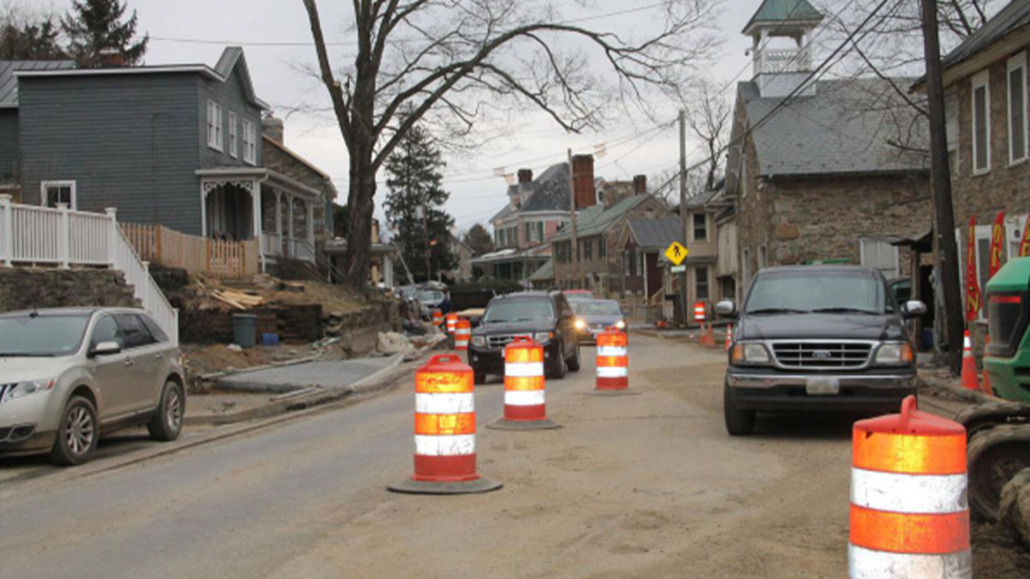
Understanding the Corridor
The project corridor spans approximately 4,500 linear feet of Route 9 between Stony Point Road and Mountain Road. A legacy VDOT topographic survey existed, but the scope required our team to update it to capture present-day conditions and constraints. To meet VDOT standards, all survey deliverables were provided in MicroStation base mapping, creating a reliable foundation for design and review.
Survey Foundation for Design and Construction
ATCS established survey and construction control using robotic total stations and networked RTK GPS to ensure precision across the corridor. When a floodplain study became a design requirement, we performed stream cross sections and bridge surveys to support hydraulic modeling.
Right-of-way support posed unique challenges in Hillsboro’s historic setting. Many parcels had never been formally surveyed, and prescriptive rights-of-way governed portions of the roadway. One key objective of the project was to resolve these inconsistencies. Our team conducted boundary and easement research, created right-of-way mosaics, and mailed owner notifications. We prepared 39 acquisition plats on an accelerated schedule, clarifying and formalizing right-of-way and ensuring proper dedication and alignment throughout the corridor.
Environmental Documentation and Permitting
ATCS prepared the environmental analyses and documentation for two roundabouts and a shared-use path through downtown Hillsboro. Our work included:
- Threatened and endangered species desktop reviews
- Wetlands and waters delineation
- Hazardous materials screening
- VDOT environmental compliance forms EQ-121, EQ-429, and EQ-555
For the shared-use path, we prepared a Programmatic Categorical Exclusion (PCE) and submitted it to VDOT for approval. We also developed a Nationwide Permit application for stream impacts.
To address cultural resources, ATCS coordinated a Phase I archaeological survey with Dovetail Cultural Resource Group. The findings were submitted to the Virginia Department of Historic Resources, which issued concurrence within the same season, allowing the project to advance with appropriate protections in place.
Solving Data Integration Challenges
Legacy drawings from earlier surveys relied on outdated CADD standards and lacked critical field detail. We reviewed and updated these datasets, verified conditions in the field, and filled gaps with targeted surveys. All sources were integrated into a single, consistent base drawing that designers and reviewers could rely on with confidence.
Coordinated Delivery, Historic Preservation
The Rethink Route 9 Traffic Calming Project transformed Hillsboro’s Main Street into a safer, people-first corridor. With traffic calming, modern roundabouts, new trails, added parking, and underground utilities, the project balances community mobility with historic preservation. The survey controls, right-of-way documentation, and environmental clearances ATCS delivered reduced project risk and created a fully coordinated platform for design, acquisition, and construction.


